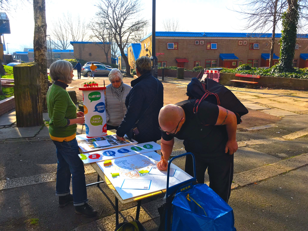
At the start of a masterplan exercise, walkabouts for community consultation are a simple yet highly productive engagement activity for residents and project stakeholders. Also sometimes referred to as walkabouts, these guided tours can be a practical starting point for any new design development project to map insight and inspirations for later design interventions.
What do residents love about their neighbourhood? What do they hate? In what ways is the place evolving? What are some hidden gems in the area?
Nothing replaces the ability to experience the place for which a design response is required in person, through all the senses, visual, scale, and the walking activity offers place experiences that are hard to see or understand when just looking at a map.
Key advantages of walkabouts for community consultation
Walkabouts are a great way to enrich site analysis. Project team members, especially architects and planners regularly undertake a site visit to understand a place. As part of early project development, you can expand these site visits by inviting resident and local stakeholders on a walkabout. Here are some key advantages of walkabouts.
- Get to know local stakeholders: At the meeting, you'll meet local stakeholders and discuss the history of the area.
- Understand valued buildings: You'll also learn about some of the buildings in town and how they fit into the community. If you're lucky, you'll get to see some architectural landmarks as well!
- Understand problems: Walkabouts of neighbourhoods are an amazing way to get a better understanding of problems faced by residents. Locals can tell you what it’s like to live in a neighbourhood and the things that are important to me.
- Capture notes on solutions: Residents and stakeholders will have thought on making a place better. Walkabouts will help develop shared understanding of those opportunities.
Inviting participants to walkabouts for community consultation
Your walkabouts are as effective as the individuals you invite to show you around. You’ll want to have a mix of residents with different perspectives. Get a small group of interested individuals together. Look at the socio-demographics of the area and reflect on who you are designing the project for. Then invite individuals who have relevant insights in the place, by living, working, or visiting there for some time.
Indeed, a local champion may also help to translate the views of other individuals into the site visit activity, without them having to engage, which is handy for marginalised groups. Look for captive audiences, such as local history groups, civic societies, business improvement district groups, and so on.
If you don’t have an initial captive audience, make your walkabouts a mini event. Look out for a busy spot where residents would linger or socialise, such as a market event, or a public space. Provide them with the opportunity to join a walking tour or provide them with materials that would prompt them to make certain observations.
Focusing your walkabouts activity
For walkabouts for community consultation, think about what observations you are trying to make whilst in the neighbourhood. The focus for the walkabout for community consultation will depend on the type of project. Walkabouts can be perceived as open and loose activity, but that risks to deteriorate the value of the insight. Ensure that you have a view on the focus for the activity.
- Is it just about noticing anything specific in specific places?
- Is it about capturing inspirations through materials or architectural styles in existing buildings?
- Is it about empty or underused spaces and what to do with them?
- Is it about movement between spaces and how to improve walkability?
To make analysis easier, consider the way the observation will be taken, and if a little structure can be provided beyond instructions such as sharing an image and an observation.
If you invite a large group of people, make sure to devising a framework with which observations could be ‘coded’. For example, Robert Potts and Dhruv Sharma provided a walking method where participants were asked to describe their observations by choosing from a set of colour coded pins.
Red (stop) | Green (can go/ cross) | |
|---|---|---|
Plus | Positive stop (a great view) | Positive go (an enjoyable walk) |
Minus | Navative stop (a blocking street) | Negative go (escape) |
A clear and easily understood coding framework as the above can be provided to participants on the day to 'mark up' their observations. At the same time, a clear framework dramatically speeds up analysis of submitted observations.
Preparing materials and maps for walkabouts
Any walkabouts for community consultation should not be undertaken blind. Typically a basic level of preparation is advised, to understand what can be gleaned from a desk study; or any preliminary conversations with clients or stakeholders.
With that in hand, it’s good to develop a few ‘starting points’ for the walkabout, and a few stop points on the way. Those could be locations in prominent or problematic areas relevant to the design. If it is possible, it’s worth it to see if those locations could be grouped by themes according to different observations to be made.
For the actual walkabouts for community consultation, it’s good to provide participants with a quick guideline as to what they are asked to do. Develop a quick set of instructions with step-by-step points. It also helps to provide an example annotation on what they are asked to contribute, which could be an image with a comment as a starting point.
For the activity, in some cases, it pays to prepare a map specifically for the purpose. The map could be different from the typical base maps found on Google maps, and draw out specific built environment features to highlight.

Temporary popups can be a great start for walkabouts
Supporting walkabouts for community consultation online
Tools like PlaceChangers platform have powerful in-built map engagement applications, for example, to support feedback on specific places. For a setup, if it is supported by a digital approach or platform, consider what devices participants might have access to. It’s also important that there is a wifi or good cellular connection; and also that participants have a basic data package on their personal devices.
Digital engagement tools, such as PlaceChangers, can helps support a guided walk. In this case, the walkabout can draw on their own devices where participants can capture photos, associated notes, and share them with the consultant and everybody else. This in turn helps to develop a shared understanding of issues and opportunities much faster than otherwise possible.
If the activity is well designed and ‘packaged’, it’s possible to make the activity available more widely to individuals via social media. Combined observations from walkabouts can be made available to participants who could not attend, giving them an additional opportunity to review what had been noted on the day.
Analysing results from walkabouts for community consultation
Analysing results from walkabouts is as much about intuition from being engaged in the various conversations from the day; as it is about more systematic analysis of responses.
Look back at the section on 'focusing your activity' above. Analysis will be much easier and straight forward if the walkabout had a defined scope.
Depending on the type of projects, you could expect some of the following outcomes:
- A collection of photos of architectural styles that people liked vs those that they did not favour
- A list of locations that have poor walkability
- Annotations for intervention ideas on various spaces and places for later design stages
An online engagement platform that supports interactive proposal maps, such as PlaceChangers, helps to facilitate the analysis by being a collection tool where observations by walkabout participants can be gathered for further analysis. Here you can also easily geo-reference observations and, depending on setup, participants could have made observations with a consistent set of response categories.
Conclusions: Walkabouts are a key component of early engagement
In conclusion, walkabouts arranged by design teams for residents are a key component in urban planning and design projects, which demand a strong user-centred approach to community consultation.
Walkabouts help to connect with residents to develop a richer understanding of issues and opportunities in a place faster than from maps and desk study alone. Walkabouts can be planned for different purposes and focuses. You can shape the focus of your walkabout for different audiences, too.
Digital tools, such as PlaceChangers engagement app, can boost walkabouts by providing an optional guide and method for logging observations for walking tour participants. That way your walking tour can be available to a broader audience and become more self-guided, thereby reducing your own resource needs.
Explore the PlaceChangers planning toolkit

PC Engagement - market leading planning engagement
Set up powerful map surveys and polls based on the changes that may come up on your estate and prioritise future planning interventions more easily.

PC Site Insights - Unique location insights tool for health and wellbeing outcomes
Start to make use of location data and enrich your community engagement planning with insights on local people. Add in your own data sources and gather analytics in one place.
