In March 2021, tired of working from my bedroom and deciding I could probably afford a bit more in rent, I started poking about on Zoopla, looking at two-bed places. After a few viewings, I ended up with a shortlist in the neighbourhood of Bensham, in Gateshead. Naturally, I pulled up the area on PlaceChangers Site Insights.
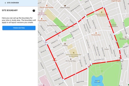
Site Insights is PlaceChangers' cutting-edge site analysis tool. Recently released, the tool gives developers and local authorities a rapid and accessible understanding of sites for housing. It also works very well in existing neighbourhoods. All I needed to do was draw a site boundary to get started.
Site Insights benchmarks critical health and well-being factors, including those of the existing population and those of a proposed or existing design. It draws on open data indicators and PlaceChangers' built-in walking distance analysis. Of course, it's most potent when combined with direct place insights: since I've moved to Bensham, I've seen how insights from the PlaceChangers platform play out on the ground.
Having lived in Bensham for a few weeks, I was curious to see how it would perform with the proposed design changes. I created new connections to support cycling and walking and got instant visual feedback. I want to show you what I found.
Meet Bensham and Saltwell
My site boundary straddles the Bensham and Saltwell wards in Gateshead.
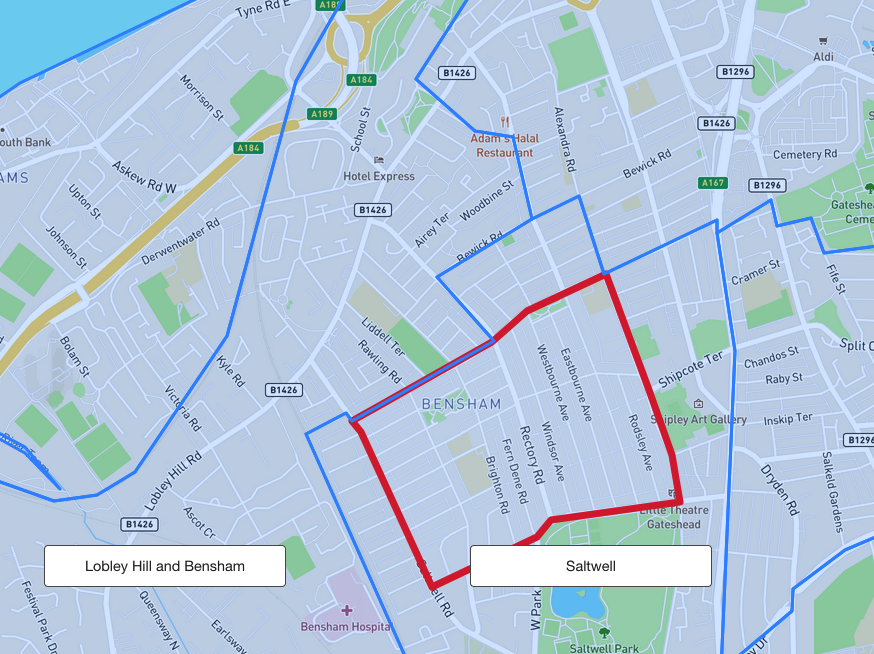
Bensham has a predominantly working-age population. A glance at ONS data (coming soon to Site Insights) shows the most prominent single employment group in Gateshead is SOC major group 2: Professionals. Interestingly, we see a much younger age profile in Saltwell, suggesting a population of young workers and families with school-age children. This squares with my anecdotal evidence: my neighbours on the north side are recent graduates, and my neighbour on the south side has a school-aged child.
Gateshead has been judged the most affordable place to find a good school - and, indeed, Site Insights shows us at a glance how much of the area has a school within a five-minute walk.
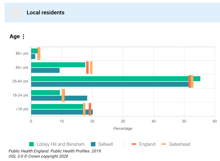
Age profile
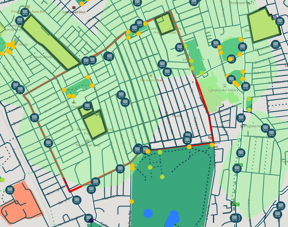
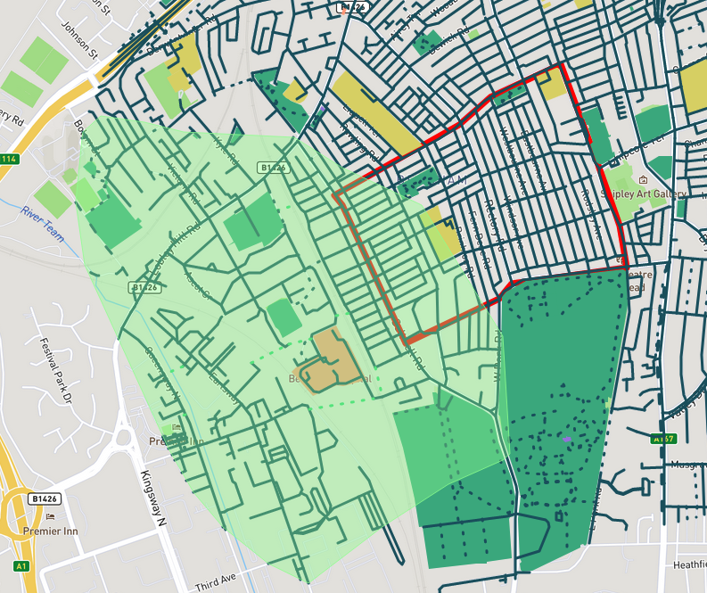
Schools within a five-minute walk
Dense and urban, the neighbourhood nevertheless scores very well on access to green space, even by the standards of Gateshead Metropolitan Borough, which includes large swathes of greenbelt (coming soon to Site Insights). Site Insights also gives us the AHAH indices, which means we can see, at the LSOA level, that Bensham and Saltwell have much higher air quality than most of England.
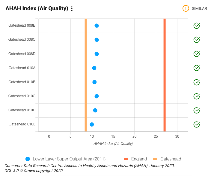
Air quality (AHAH index)
Bensham is spoiled for greenspace within walking distance: In addition to Saltwell Park, the area has many pocket parks, playgrounds and sports fields, and Site Insights' active travel modelling shows that greenspace accessibility is excellent in this neighbourhood.
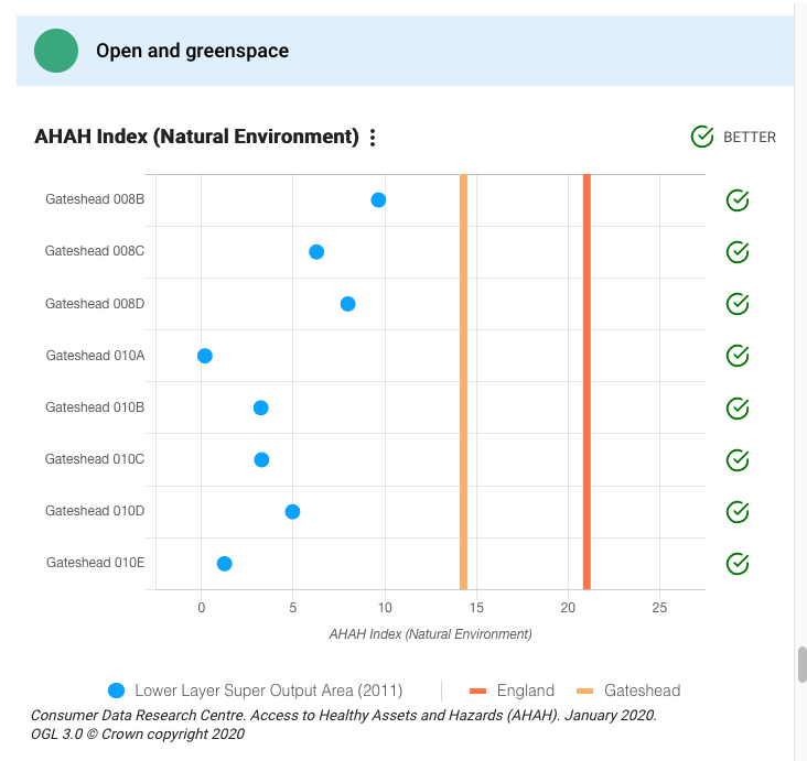
Access to open and green space (AHAH index)
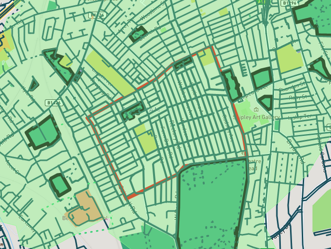
Greenspace coverage map for 5-minutes walk
When community group Best of Bensham used the PlaceChangers platform to consult on potential interventions in late 2020/early 2021, greenspace was an overarching theme of responses from residents. Local green space is essential to residents keen to maintain and improve the area's open spaces. Many of the suggestions arising from that campaign have since been undertaken by Best of Bensham, working hand-in-hand with community members.
Strengths and weaknesses
Bensham and Saltwell is a great place to be for active travel. It is within a short cycling distance of two major employment centres: Newcastle city centre and the Team Valley Industrial Estate. It's unexpected, then, to discover that residents of Gateshead cycle less than the nation on average. More surprisingly, they walk significantly less than the nation and less than the North East.
We find the population of Gateshead has a higher prevalence of obesity than the nation on average. What do we see here? What are the underlying causes? The Site Insights recommendations engine suggests looking at unhealthy food outlets and food poverty. Indeed, we can see Bensham scores very poorly on access to junk food and levels of multiple deprivations.


The Indices of Multiple Deprivation (IMD) indicator shows that Bensham and Saltwell are more deprived than the rest of England and the rest of Gateshead.
The AHAH index, an open data index focused on health outcomes, tells me that the neighbourhood has a poor balance of healthy retail outlets. This squares with my experience here. While the area has abundant high-quality green space, housing and schools, it also has an abundance of fast-food takeaways and off-licences selling alcohol and tobacco.


Improving walkability
Bensham is a target area for interventions that encourage walking for travel. What kinds of interventions would make a real difference here? The latest active travel data on Site Insights is from 2019. The National Travel Survey from 2019 shows that the most common reasons for travel are shopping (21%) and commuting (20%). When residents of Bensham and Saltwell go back to the office, will they be walking to work? Could they be?
I’ve configured my site boundary to include a buffer of 800 meters for context analysis. The Team Valley Trading estate is, in fact, inside that buffer. There is a large, rather handsome-looking block of offices in Team Valley, called Maingate, on the other side of two sets of train tracks, a fork in the East Coast Main Line.
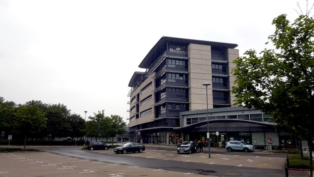
Employment location in Team Valley trading estate
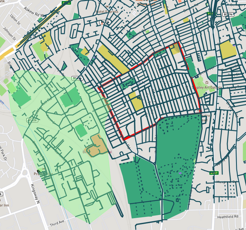
15-minutes walking access from employment location
I have no intention of working from home forever, and PlaceChangers will certainly rent office space as we grow. If we chose to work at Maingate, would I be able to walk there from my home within 15 minutes? Site Insights can answer this question for us.
Due to a lack of crossings under the tracks, this commercial centre is not, in fact, walkable from my site within 15 minutes. Several relatively small interventions can improve this. Site Insights allows us to try things out risk-free and picture their effects on walkability.
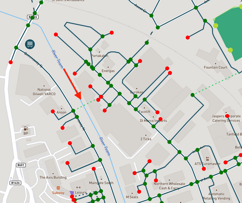
First, let's add another underpass at each railway line and one additional path to link them.
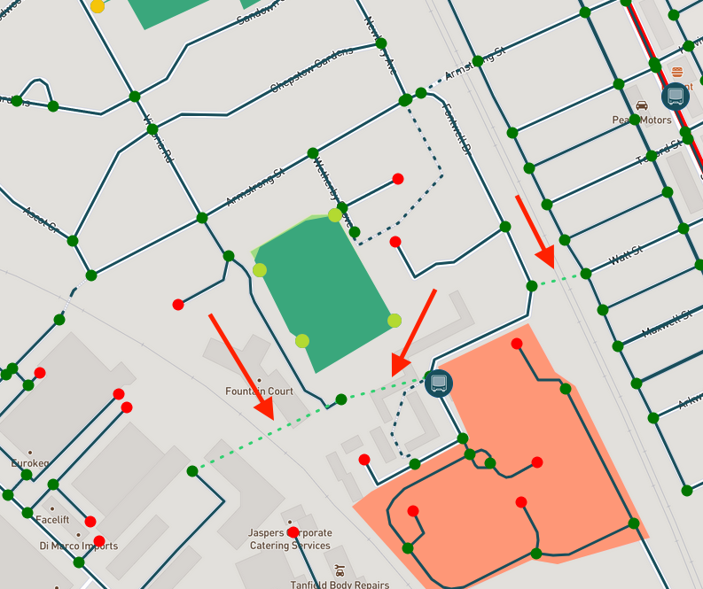
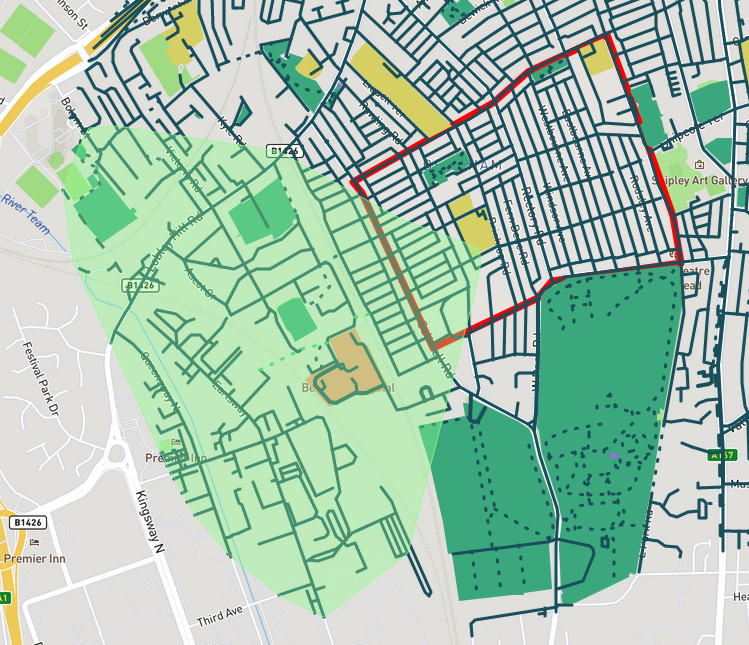
Second, let’s add another underpass and connect it to the existing southern underpass - and then connect both to the grid.
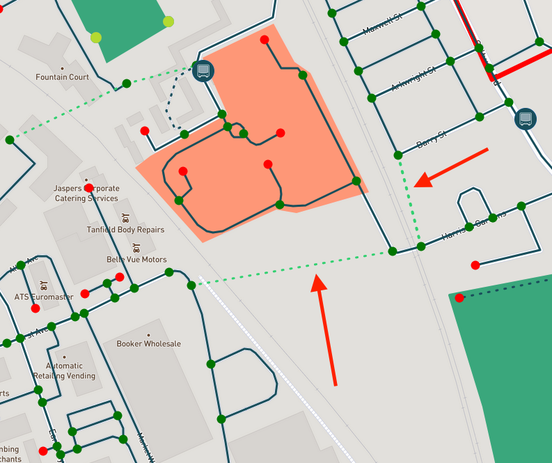
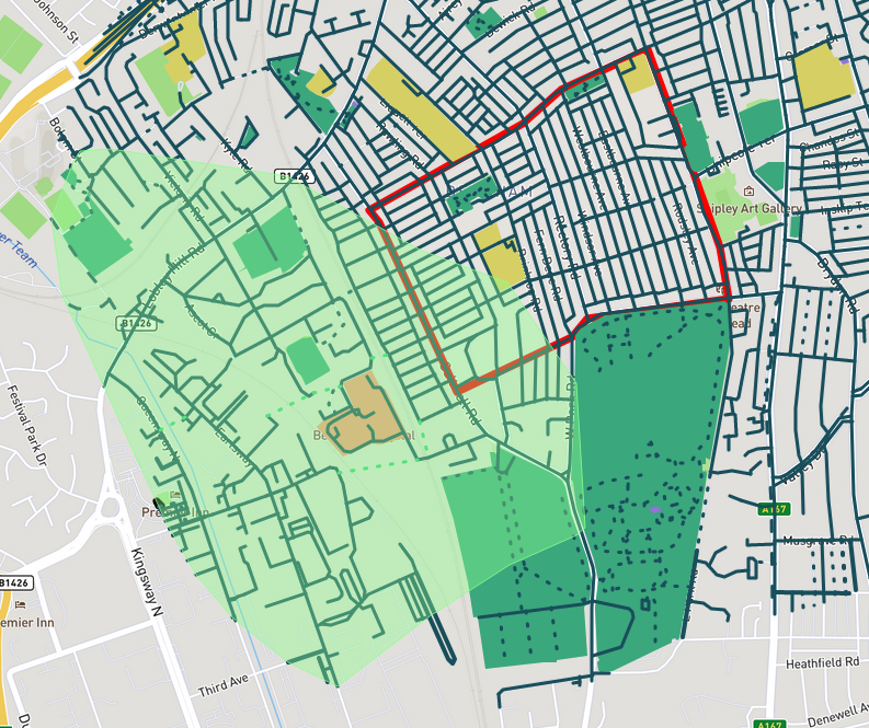
Finally, let’s add a bridge over the Team.
A view from the ground
There might be a business case here. How feasible are these interventions? The first thing we'll need to do is a site visit. Doing the walk from my place to Maingate, I notice that Gateshead Council has already done decent work on their side. Armstrong Street, which connects Bensham to the Team Valley Trading Estate, is very straight and walkable, with footpaths and grass verges. The underpasses are as short and about as attractive as they can be.
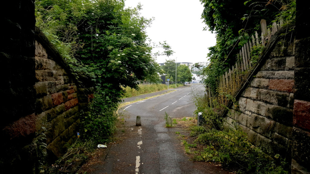
Existing underpass 2
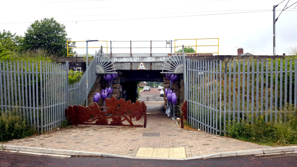
Existing underpass
Unfortunately, the path is not well signposted. Where is the big sign at the top of Armstrong Street saying “This way to Team Valley Trading Estate”?
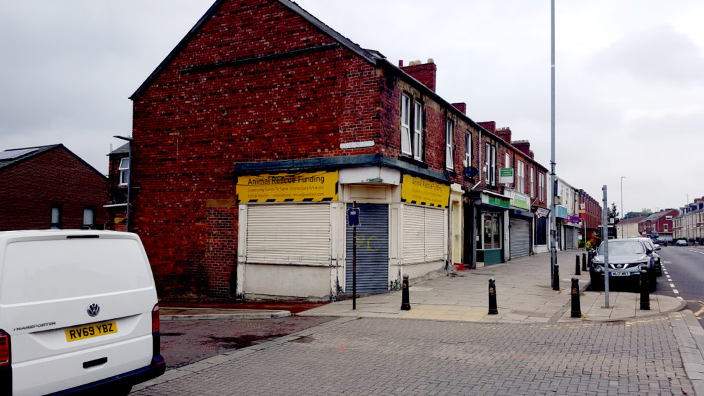
Missing signage on Saltwell Road
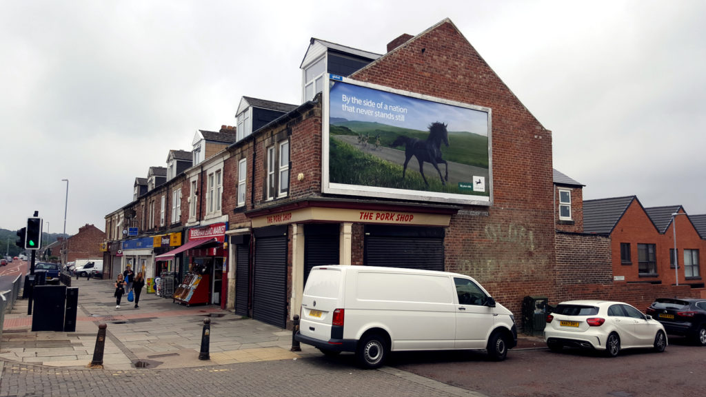
Missing signage on Saltwell Road
I'd like to see Armstrong Street reproduced two more times, to the south, but there may be reasons why it hasn't happened. Let's see how we get on once we're in the trading estate. At the end of Armstrong Street, we are greeted by a blue fence with warehouses behind it.
"Welcome to the labyrinth," the estate seems to say to us, "Good luck." Not even a pedestrian map of the site. This location is where my bridge across the Team would be. As you can see in the photo, Maingate is directly ahead of me, but I have no idea how to get there.
At least from this access point, the Team Valley Trading Estate is impermeable and illegible. It isn't the first industrial estate I've seen designed this way. It inclines one to wonder why we do it to ourselves. Take a look at Maingate from the back, and I think we can guess what the explanation might be.
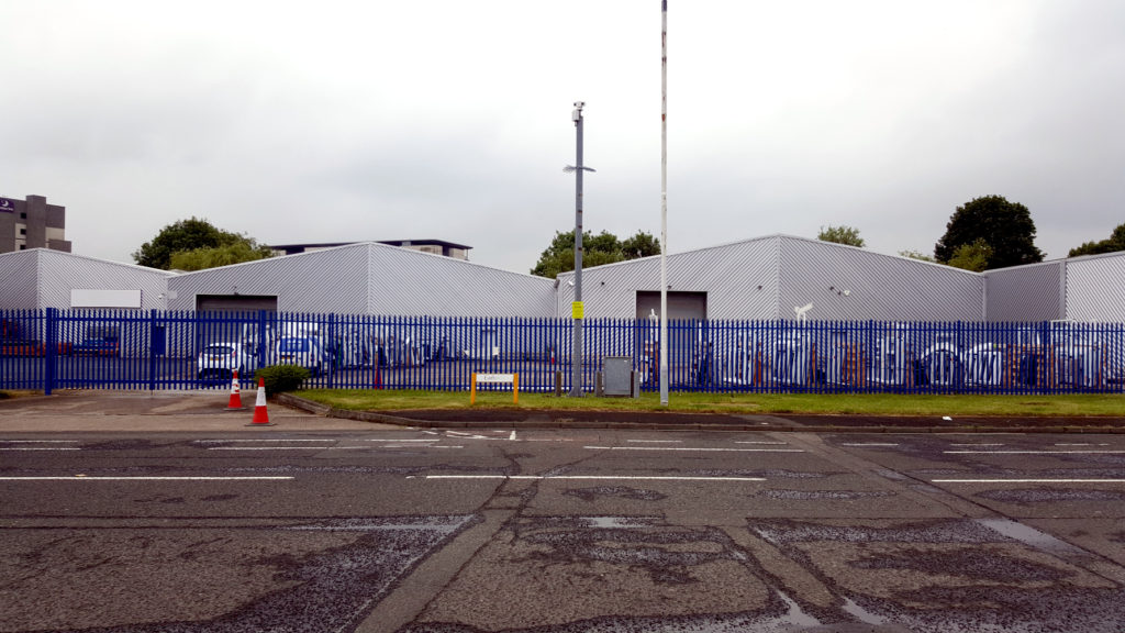
Pedestrian experience entering the trading estate
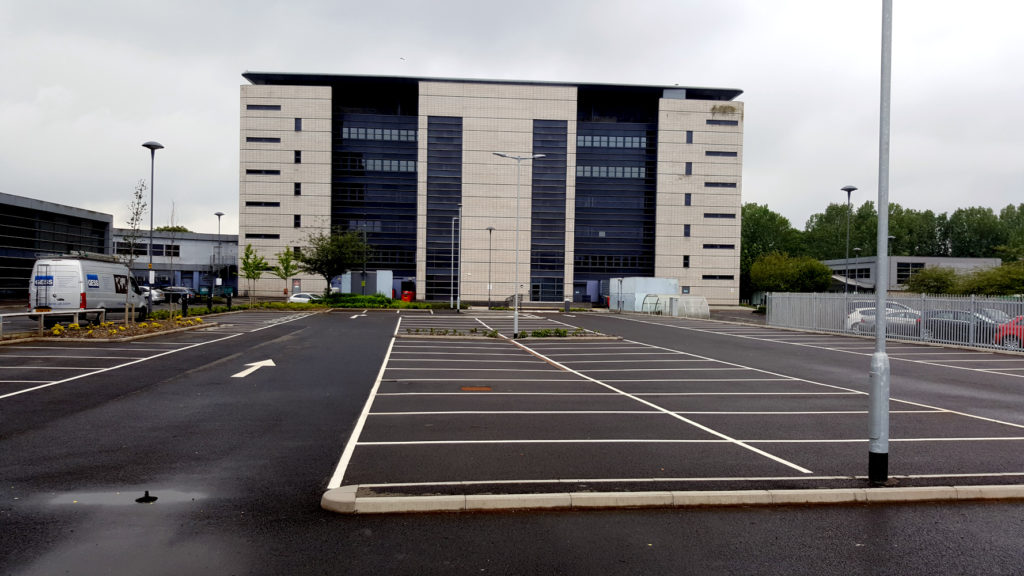
Regus office space
I wonder what modes of transport Regus expects its tenants to use. As it happens, Team Valley Trading Estate was designed in the 1930s by William Holford, the same man whom the Australian Government commissioned to develop the plan for the national capital in the 1950s. I've written about Canberra's struggles with car dependency. Bensham existed in Holford’s time, so one can only wonder why he designed the estate for car users from elsewhere.
Of course, the culture of car dependency feeds itself: the more we expect people to drive rather than walk, the more we build infrastructure that's friendly to cars and hostile to pedestrians. To the south of Bensham Hospital, my second underpass would be at the back of the Tyneside Royal Mail Centre.
The Team Valley Trading Estate is privately owned, so Gateshead Council can't do much about this. The real question is whether Team Valley is missing a trick here. What kind of economic opportunities present themselves to a Team Valley open to pedestrians walking in from Bensham and Saltwell?
What kinds of economic opportunities present themselves to a Bensham and Saltwell that's within walking distance of Team Valley? For now, these questions remain outside the scope of Site Insights.
Conclusions: Understanding health & wellbeing in urban planning
In this article, I've demonstrated that PlaceChangers Site Insights is very good at presenting a picture of the opportunities on the ground in my neighbourhood. From the instant desktop review, we were able to understand the kinds of people who live in the area, their health advantages, and the challenges they face linked to the built environment. We were able to test interventions and see, in real-time, their effects on walking distances. This was possible, having provided nothing more than a site boundary.
Open data indicators drive site Insights. It works for any site in England, and it is undergoing continuous improvement all the time. My motivation for using it was, very simply, that I was considering moving to the neighbourhood in question. Having been locked inside for eighteen months, options for active travel and access to green space had become very high on my list of priorities for that move.
I'm not the only one that feels this way. 2021 has seen strong demand in the property market, and COVID-19 has dramatically changed what people look for in a property. I've demonstrated above that there is a use for Site Insights, complemented by relevant expertise, in scoping options for a business case. I am not an urban designer or a land manager. Nevertheless, very quickly, I was able to find shortcomings in the built environment and potential solutions.
More broadly, I've demonstrated the place that a data-driven, digital approach has in the immediate future of urban design in this country. Forward-thinking developers will use tools like Site Insights to gain a competitive advantage.
Explore the PlaceChangers planning toolkit

PC Engagement tool - Market leading interactive planning consultations
Set up powerful 2D and 3D map surveys and polls for your planning or construction project and adapt proposals easily.

PC Site Insights tool - Place analytics tool for town planning
Make use of powerful place analytics to support briefs, engagement planning, and impact statements.
