This article is about 'ped sheds', or walking-distance-based analysis of a place. Read on how ped shed analysis can help you better understand a place and devise powerful strategies for intervention supporting accessibility.
The Covid19 pandemic accelerated interest in health, wellbeing and walkable cities. Access to facilities and green spaces was critical for citizens' physical and mental health. Lockdown restrictions allowed and encouraged people to get outside and have an hour of physical exercise. For many communities, this was limited to footpaths as access to green spaces was difficult or beyond a walkable distance.
In default planning exercises, early project briefs, or access and design statements, it's often commonplace to use a straight-line radius from a centre point to define citizen accessibility to facilities and parks. This analysis is less likely to capture accessibility by actual walking distance.
What is a “ped shed”?
A pedestrian shed (ped shed) defines the pedestrian catchment of a location related to the walking distance to or from a destination rather than a radius from a centre point. The area is encompassed by walking distance from a local community asset, town centre, neighbourhood centre, or other location.
Ped sheds are often defined as the area covered by a 5-minute walk (about 0.25 miles, 1,320 feet, or 400 meters) as we would comfortably walk this distance every day. Ped Sheds are the basic building blocks for walkable cities and should be considered in all urban planning exercises.
By generating these ped sheds, urban planners can determine comparative estimates of how easy it is to travel within the location under review and how they can optimize the design.
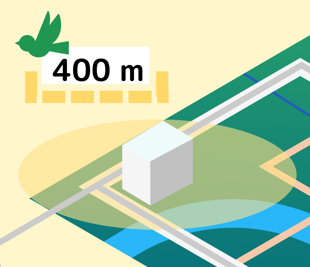
 | Radius in Meter and direct distance. This distance type creates a buffer using straight-line distance (Euclidean distance) from the facilities (ex., within 300 meters of parks). The resulting layer is a circular buffer showing an equal distance from parks. While simple, this analysis has essential weaknesses as it assumes that people can walk through houses and other obstacles. |
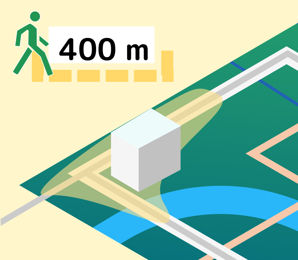
 | Route in Meter and walking distance. This distance type creates a buffer by using the network distance from the facilities. The resulting layer is an irregular polygon showing the distance traversed using the road network. A 400-metre distance is generally seen as the distance we would comfortably walk daily. This is the default mode in PlaceChangers Site Insights. |
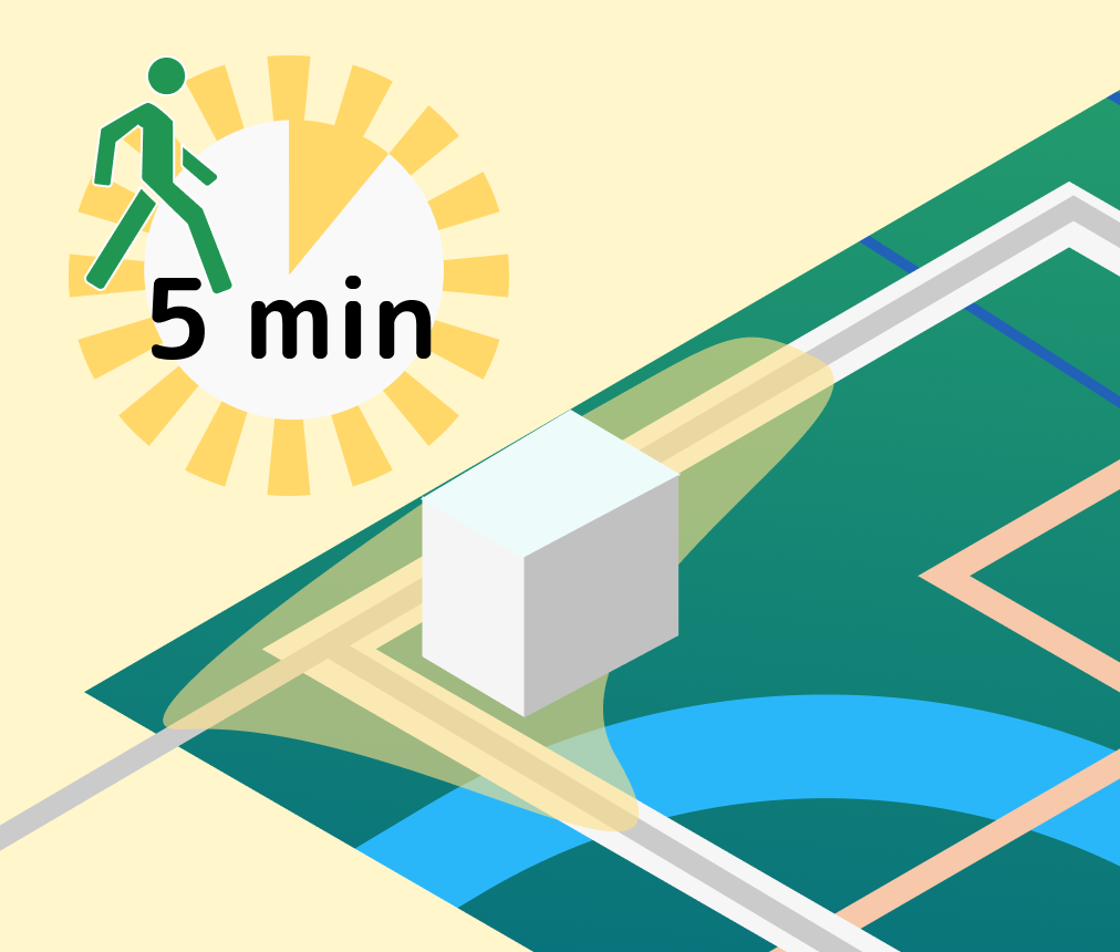
 | Route in Minutes and walking distance. This distance type creates a buffer by measuring the actual distance that can be traversed in a given time from the facilities, for example, within five minutes from green space areas. The walking speed differs as we age, and this analysis can account for the needs of different user groups. |
Sustainable Development
The last two years have heightened the focus on sustainable, Net Zero development. Urban planners are more interested than ever in determining the walkability within urban areas and the ease of access to public facilities within them.
To decrease the carbon footprints generated by expanding urban centres, higher-density developments and improvements to existing infrastructure can help people walk more and make the most of recreational areas, health, education and transport facilities.
This is where ped shed analysis based on actual walking distances enables better design and planning of built environment projects to ensure better health and wellbeing outcomes for communities.
How to do a simple ped shed analysis on PlaceChangers
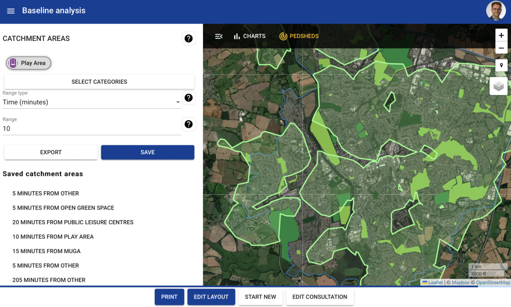
To do a simple ped shed analysis, you don't need a complex GIS system. For example, on a platform such as PlaceChangers, planners regularly generate powerful visualisations based on actual walking access using sophisticated access analytics.
The steps include the following:
- Define a study area
- Pull in relevant locations (e.g. various open space types)
- Set up a series of ped sheds relevant to user groups, for example, by location type and walking distance (e.g. 5-minutes walking distance coverage for play grounds vs 15-minute walking distance for all tennis and gyms).
- Visualise your analysis to identify gap and 'black spots' easily.

Conclusions
Access to an iterative mapping of ped sheds allows planners and designers to adjust their designs to ensure better community outcomes quickly. More local authorities recognise the health benefit of walkable places and request that walkability is considered in development applications. The ped shed analysis tool on PlaceChangers helps generate these insights easily.
Analysis that properly considers network distance, such as available in PlaceChangers Site Insights, is much more realistic than straight-line distances since it considers the actual road network distance and any physical barriers. By generating these ped sheds, urban planners can determine comparative estimates of how easy it is to travel within the location and how they can optimize the design for effective and efficient development projects.
Digital mapping platforms like PlaceChangers provide enhanced capabilities that enable you to deliver a graphic representation of the area surrounding a particular destination that can be reached on foot within a specific walking time. These kinds of coverage maps reflect accessibility more accurately than coverage by straight line distance and effectively highlight issues and opportunities with greater nuance.
With tools like PlaceChangers, a designer or planner can drop a pin on the interactive map on the PlaceChangers platform and then plot the areas within a five-minute walk from urban centres. The maps generated are called isochrone maps depicting areas of equal travel time.
Explore the PlaceChangers planning toolkit

PC Site Insights - Unique location insights tool for health and wellbeing outcomes
Start to make use of location data and enrich your community engagement planning with insights on local people. Add in your own data sources and gather analytics in one place.
